


A development application before Redland City’s planning authority proposes to carve 189 homes from a former grazing property on Scenic Road in Redland Bay, with a median lot size of 350 square metres and 80 lots at 350 square metres or smaller, in a shift that reflects the national housing density conversation landing on a bayside suburb that built its identity on space.
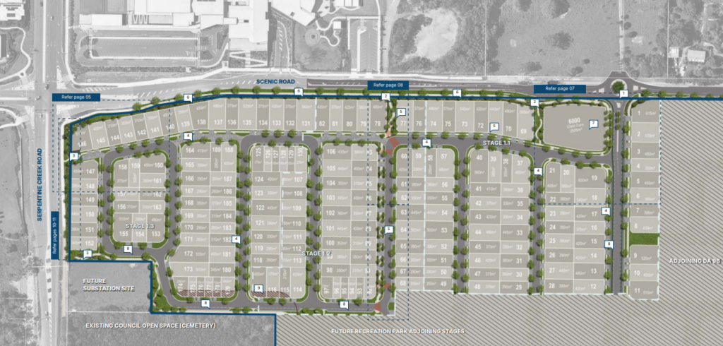
The application, lodged as RAL25/0090 and part of the broader Shoreline masterplan, covers 11.54 hectares of a 16.6-hectare landholding on Scenic Road, directly across from a separate 294-home Stockland development already under way and the newly opened Scenic Shores State School.
The two estates will place 483 homes around a single primary school, a density that has already prompted warnings about traffic and parking in the established stage.
The land is owned by Alan Gordon Wilson, whose address is listed as Fiteni Homes in Capalaba. He has granted Stockland’s development arm power of attorney to seek approvals, subdivide and sell the lots.
A block size that is half what the suburb used to accept
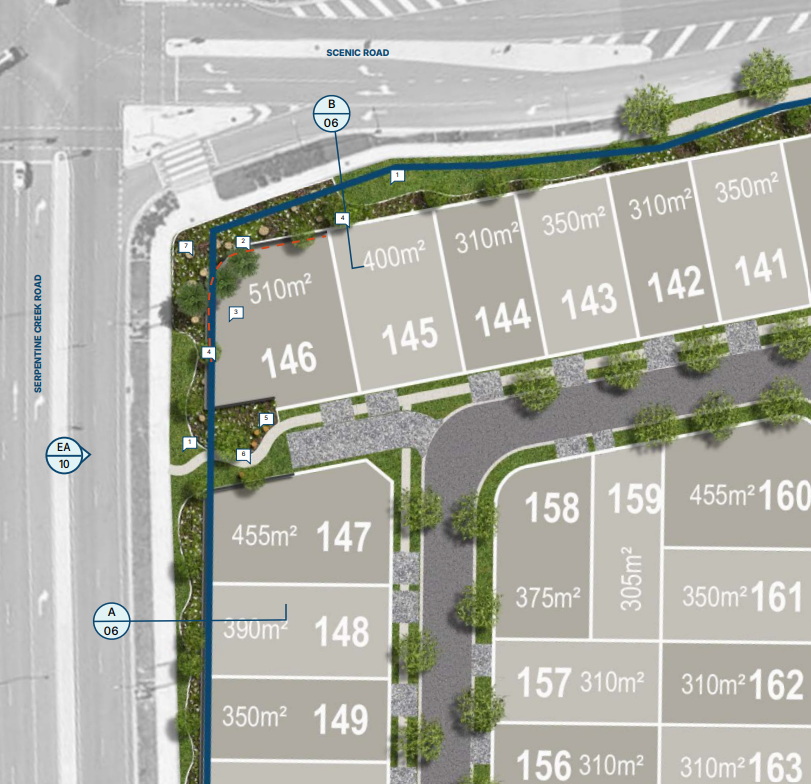
The numbers inside the application tell a clear story about where housing density is heading in South East Queensland’s growth corridors. Planning material by Saunders Havill confirms 42.3 per cent of all lots, 80 in total, will be 350 square metres or smaller.
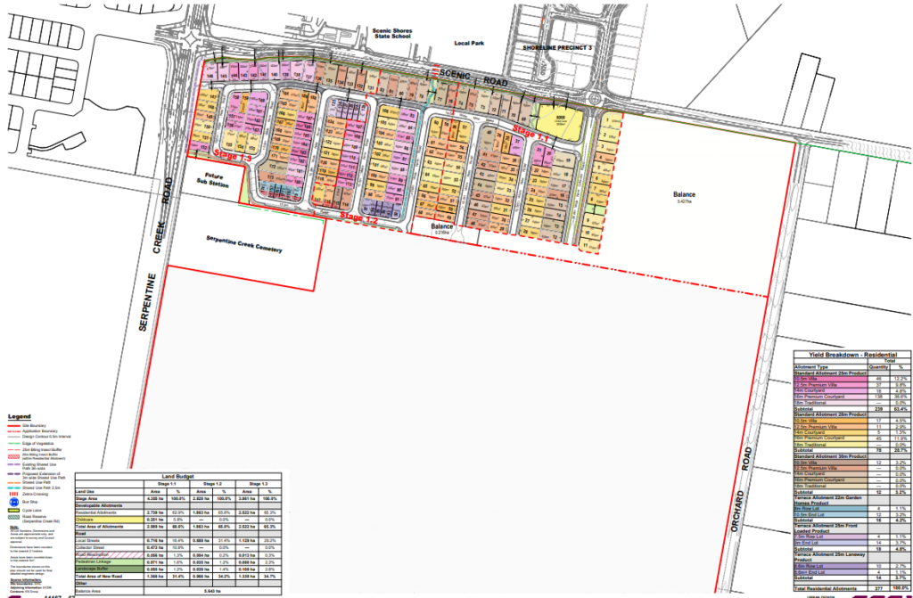
Four lots measure just 155 square metres, several sit between 180 and 200 square metres, and only one lot in the entire estate exceeds 600 square metres, the size that has long defined the south-east suburban standard.

The proposed density reaches 16.37 dwellings per hectare against a planning scheme benchmark of 15. The application acknowledges it does not meet key “probable solutions” in the planning scheme but argues the smaller lots facilitate housing choice and affordability. A 6,000-square-metre childcare site is also included, along with internal roads.
Stockland said the proposal had been designed within planning requirements. “The proposals were prepared in line with the Redland City Plan and are supported by technical studies covering traffic, access, parking and servicing, including consideration of peak school-time movements, with all homes to be connected to essential infrastructure,” a spokesperson said.

“Shoreline has been planned as a well-connected, family-friendly community that provides much-needed housing close to schools, open space and local services.”
The constraints the site carries
The application navigates a site with several significant constraints. Flood overlays affect parts of the land. Acid sulfate soils are present.
The western boundary abuts the heritage-listed Serpentine Creek Road Cemetery, a historical burial ground dating to Redland Bay’s farming era in the 1880s, which adds a sensitivity to how the boundary treatment is managed.
The estate also relies on a temporary sewer solution for now. Wastewater will be stored in six on-site tanks and removed by trucks until a permanent connection is officially opened.
The broader Shoreline infrastructure agreement requires construction of a reticulated sewer system designed to service an expected 10,000 new residents across the full masterplan, but that permanent solution is not yet available for this stage.
Each home must provide two on-site car spaces, but visitor parking will rely on internal street access lanes. No public open space is included in this stage, with parks in other parts of Shoreline intended to serve the precinct.
Redland Bay’s farmland era coming to a close
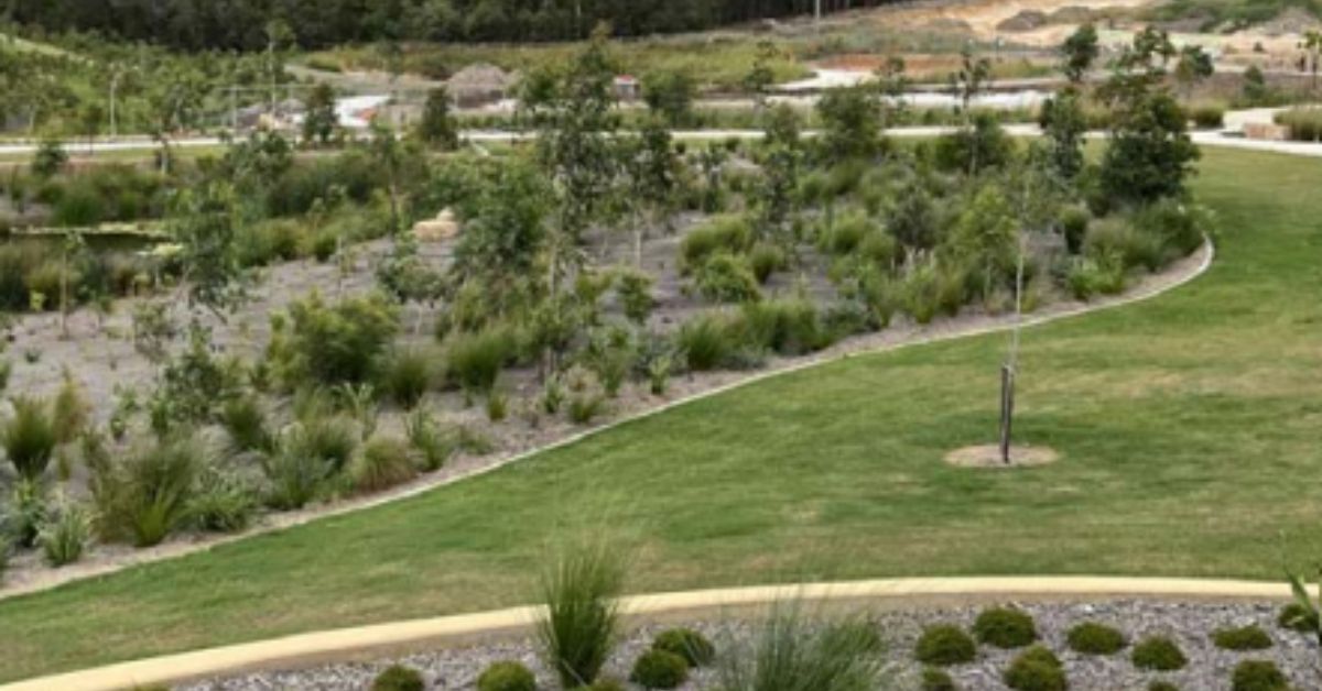
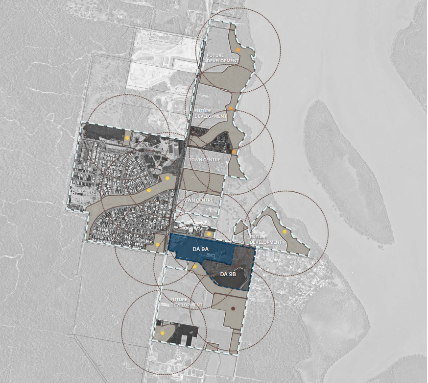
The Shoreline project is a 279-hectare masterplanned community located to the south of the existing Redland Bay township, progressively converting former farming land into housing through staged subdivisions since its preliminary approval in 2015.

The community sits 43 kilometres from Brisbane CBD with access to Cleveland train station via bus connections, and markets itself around Moreton Bay water frontage and views toward North Stradbroke Island.
Redland Bay’s history as a fruit-growing district, primarily bananas, oranges and pineapples, dates from the late 1880s when the area emerged as a prosperous farming community after earlier sugar cultivation gave way to competition from north Queensland.
That agricultural past is now almost entirely gone, replaced by the masterplanned estates and state school that define the suburb’s southern expansion.
The application, RAL25/0090, is before Redland City for assessment. Details are available at here.
Published 6-June-2026
Featured Image Credit: DA RAL25/0090